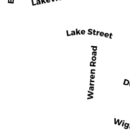
12 WIGHTMAN RD
Owner Information
NEARY JOHN P
0012 WIGHTMAN ROAD
TEWKSBURY, MA 01876


Property Details
12 WIGHTMAN RD is classified as a Single Family Residential (Colonial).
The primary structure on this property was built in 1962. There are 2,320ft2 of built area within this property. There is 1,372ft2 of residential/living space within this property.
12 WIGHTMAN RD is valued at $337,300. The land is valued at $163,100 and the structures are valued at $172,100. There is an additional valuation of $2,100 on this property.
This property is in Zone R40. Confirm with local Zoning Board authorities to ensure there are no overlays or other easements on this property.
The most recent deed for 12 WIGHTMAN RD is recorded at the local registrar in Book 06589, Page 0154. 12 WIGHTMAN RD was last sold on Tuesday, July 27, 1993 for $1.
Assessment data from fiscal year 2021.
Flood Data
According to the FEMA National Flood Hazard Layer, this property does not appear to be in a flood zone. It may also be in an area not yet reviewed. Nonetheless, confirm this information prior to taking any action.
To view the flood hazards around this property, create a FEMA "Firmette" Map of the area around 12 WIGHTMAN RD.
Broadband Internet Providers
| Provider | Type | Bandwidth (mbps) | |
|---|---|---|---|
| HughesNet | Satellite | 25 | 3 |
| Viasat Inc | Satellite | 100 | 3 |
| Verizon New England Inc. | Fiber | 940 | 880 |
| Comcast | Cable | 1000 | 35 |
| GCI Communication Corp. | Satellite | 0 | 0 |
| VSAT Systems, LLC. | Satellite | 2 | 1 |
Broadband service provider data from December 2020.
Adjacent Properties
- 31 DUDLEY RD
Single Family Residential owned by DREW WARREN FOSTER - 16 WIGHTMAN RD
Single Family Residential owned by COLLINS WILLIAM H JR - 2 WIGHTMAN RD
Single Family Residential owned by SEDERQUIST JOSEPH & SUSAN - 15 DUDLEY RD
Developable Residential Land owned by SEDERQUIST JOSEPH & SUSAN - 23 DUDLEY RD
Single Family Residential owned by TRAN ANDY